

Menu

Search the PDAS site

Winter
Lecture Reports
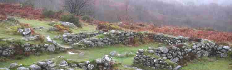
Out from the Shadow of Dartmoor
25 Years of Air Survey and Post-
1st December 2008
Frances Griffith
When Frances Griffith first came to work in Devon, the only known pre-
Professor J.K.S. St Joseph had been the first to undertake regular reconnaissance flights over Devon from his base in Cambridge. However most lowland farms in Devon have long leys followed by a year of cultivation. This means that they have neither retained their earthworks nor been the subject of regular field walking, so the number of prehistoric sites has been underestimated. Crop marks are the result of using different soils to in-
Dickie found the hill fort at Raddon, but the excavation only came about when it was crossed by the entrance road to a new reservoir. A complex including a giant enclosure was discovered at Nether Exe because the area containing a cursus was sown with beans. This explained the numerous flint implements found by John Uglow over a life time. A transect will shortly be cut at a site Frances has found at Broadclyst when a sewer is put in. At Bow, she believes this ceremonial site may be the place that gave rise to all the ‘nymet’ place names. Mount Folly has, of course been the site of one of the longest running community excavations. Now in its fifth year, many members of PDAS have taken part in the excavation. It is a huge landscape where more than 2,000 pieces of pot have provided evidence of trade from Spain, France and up and down the Channel, all between 300 BC to 300 AD.
All the sites Frances finds are recorded on what was the ‘Sites and Monuments Register, but is now called the ‘Historic Environment Record’ and everyone is welcome to make an appointment and come and use it. However few of these sites are listed and many of them are under threat from ploughing. When a site is identified, one of her team goes out and looks at the site on the ground hoping to encourage the farmer to bring it under benign management. Only if someone puts in a planning application will there be an excavation first. They are encouraging such farmers to take part in the Countryside Stewardship Scheme, but even this has a limited life. An interested and preferably enthusiastic farmer makes all the difference, particularly if he keeps a site under grass and hopefully preserves it for future generations.
Joan Price
| January |
| February |
| March |
| April |
| May |
| June |
| July |
| August |
| Septmber |
| October |
| November |
| December |
| Pollen Analysis |
| Archaeology of Gardens |
| Identifying Prehistoric Pottery |