

Menu

Search the PDAS site

A DARTMOOR LANDSCAPE FORMED BY FARMERS AND TINNERS.
Leader: Bob Bruce
Monday 2nd June 2008
Most members seem to have been put off by the wet weather that day, and only about twenty attended. The weather smiled on us and we all stayed dry!
With in a few yards of the car park Bob took us to some tin workings from the nineteenth century. Here we were clearly able to see the site of a former water wheel that had been used to drive the mine machinery. The line of the leat was still visible, and we set off to follow its line back towards its take off point on the Newleycombe, enroute passing various waste lumps and bumps from the early tinners. Much of it created by the process of streaming.
We progressed up the valley and came upon some huge “open cast” tin mines, and were able to pick up the leats that were used for washing and extracting the ore. Some of these were taken directly from the rivers, but others were simply fed from moor land runoff water, with the resulting flow captured in small reservoirs.
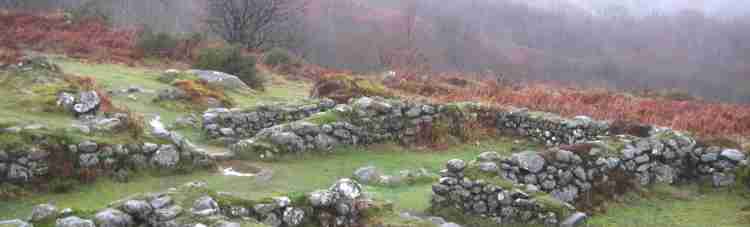
Across the valley we were able to see a few small abandoned farms these having been deserted because the water company felt they were a pollution threat! (Nothing new there)! At the top of Down Tor we came to probably the finest stone row and circles on the moor along with an associated reeve, and thence to the settlement of hut circles dating from around 1500B.C.
To round of an exceptional evening Bob took us down to see the two Combeshead farms with the remains of their livestock buildings houses and rickyards. The final building being one that the Park Authority has stabilised, and is a fine example of cattle shed which formerly had a feed loft over the cattle ties.
Richard Bennet
Archaeology
Field Trip Reports
| January |
| February |
| March |
| April |
| May |
| June |
| July |
| August |
| Septmber |
| October |
| November |
| December |
| Pollen Analysis |
| Archaeology of Gardens |
| Identifying Prehistoric Pottery |